")
The online, open access Africa Groundwater Atlas was launched in 2016. Bringing together information from multiple sources, it provides an overview of hydrogeology, groundwater resources, and its management for each country in Africa. Furthermore, it includes supporting general information relevant to the African context, for example, on climate, groundwater quality, groundwater use, recharge processes, and techniques for developing groundwater. It also includes the Africa Groundwater Literature Archive, an online library of documents (many available digitally online) on groundwater in Africa, searchable by title, author, thematic keywords or by location.
Recently, extensive new content has been added to the Atlas, including the following:
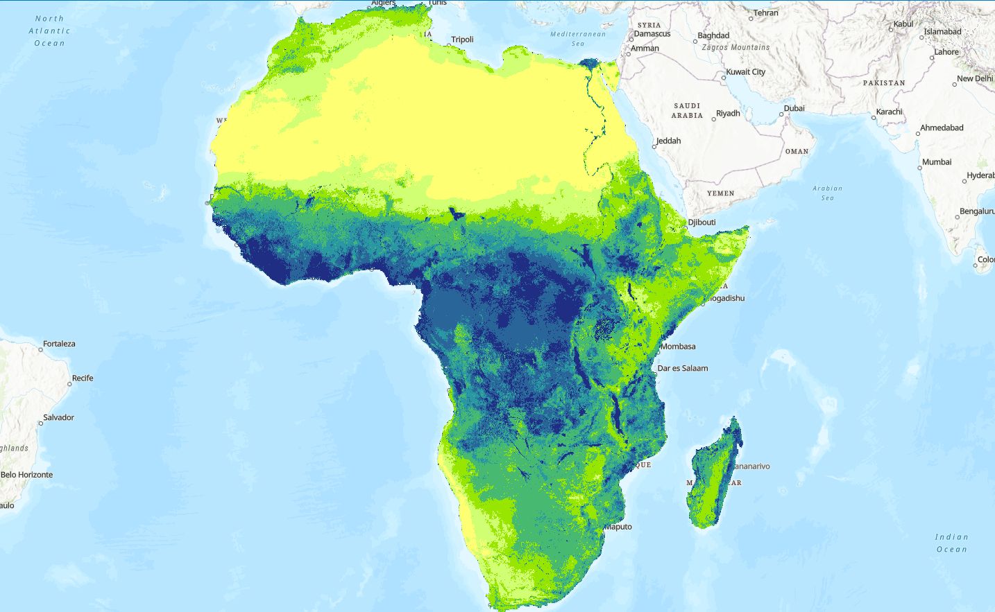
- Digital, geographic information system (GIS)-enabled country-level hydrogeology maps for 38 countries, freely available to download (maps for remaining African countries to follow).
- Expanded Africa Groundwater Literature Archive, which now references nearly 9,000 documents, of which 4,000 have web links to full text documents (if open access) or abstracts, and many can be searched via an interactive map.
- Additional French language versions (in addition to English) of key Atlas sections, presently for 19 francophone countries.
- Case studies providing practical examples of groundwater management interventions at different scales, and in different hydrogeological and sociopolitical environments across the continent. For example, a case from Lusaka, Zambia, on groundwater quality in an urban area, or one from Ghana on small scale groundwater irrigation.
At the 46th IAH Congress in Malaga, Spain (September 22-27, 2019), a Wikipedia edit-a-thon was held, where congress delegates learned how to create and edit Wikipedia pages, instructed by a professional Wikipedia Editor. Translating information from the Africa Groundwater Atlas into less-technical language, the aim is to reach an even broader community of interested people through Wikipedia.
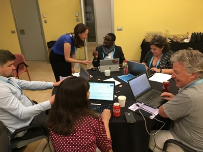
Participants at the Wikipedia edit-a-thon for the Africa Groundwater Atlas during the 46th IAH Congress in Malaga, Spain (Photo: Brighid Ó Dochartaigh, BGS)
As an example, the page Groundwater in Nigeria was created in just a couple of hours by the team of delegates. While Wikipedia does not have the same editorial control as peer-reviewed scientific publications, its strength is that it can be easily edited and new information added by anyone, anywhere in the world. The new Wikipedia pages are a potentially powerful means for the groundwater community across Africa to share knowledge. This is an ongoing project. If you are interested in getting involved, please send an email to this address for more information.
The effective and sustainable development of groundwater resources is critical to future-proof water supplies in Africa, and this has a key role in economic and social development, and ensuring food security. Achieving this depends on a good understanding of groundwater and hydrogeology. However, historically, it has been difficult to find and obtain high-quality information about groundwater in Africa. The Africa Groundwater Atlas is helping to increase accessibility and availability of information about the resource in the region. It is already widely being accessed by a broad range of users, including hydrogeologists, water supply practitioners, policy makers, and researchers across Africa and beyond, with thousands of web visits each month and increasing citations in published scientific articles and reports. The release of the digital/GIS country hydrogeology maps will further increase the usefulness of the Atlas. The non-technical country groundwater summaries in Wikipedia, which can be added to and expanded by anyone with new evidence, could be another powerful resource to increase the availability and visibility of groundwater information for Africa.
The Africa Groundwater Atlas is accessible at http://www.bgs.ac.uk/africagroundwateratlas/index.cfm. It is developed primarily by the British Geological Survey (BGS), a partner in the Groundwater Solutions Initiative for Policy and Practice (GRIPP), within the UPGro research program, funded by UKAid and UK research councils, in collaboration with the International Association of Hydrogeologists (IAH) and groundwater experts from across Africa.
For more information, email AfricaGWAtlas@bgs.ac.uk
To sign up for GRIPP news and updates, click here.
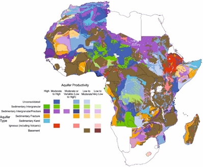
Country-scale hydrogeology maps currently available to download from the Africa Groundwater Atlas, showing a combination of aquifer types and aquifer productivity (source: Africa Groundwater Atlas/British Geological Survey).


, Civil and Environmental Engineering")