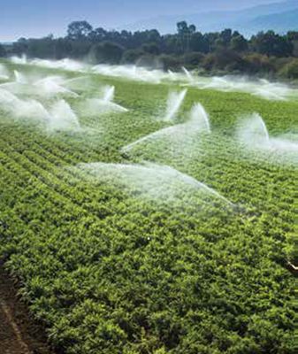
Center pivot irrigation in California (photo: TNC).
Managing groundwater sustainably relies on clear definitions of where the resource exists and is being used. However, as the demand for fresh groundwater increases, wells are drilled deeper to access more, and sometimes also lower quality, groundwater. While most groundwater basins are clearly mapped horizontally, the vertical extent of groundwater basins is often less well defined. When implementing groundwater laws in water-stressed regions, such as the Sustainable Groundwater Management Act in California, defining and mapping the basin bottom is critical for determining the sustainable yield. This helps to protect the basin from over-pumping or encroachment of deeper saline water, and avoid interferences from deep oil and mineral exploitation.
California passed its formal groundwater legislation in 2014, the Sustainable Groundwater Management Act (SGMA), in order to better deal with the many challenges in a more rigorous and controlled manner, with clear guidelines and regulations on how to ensure long-term sustainability by 2040, and with the key objective of bringing basins into balance. SGMA defines ‘sustainable groundwater management’ as: “The management and use of groundwater in a manner that can be maintained during the planning and implementation horizon without causing undesirable results,” which include the following:
- Chronic lowering of groundwater levels.
- Reduction of groundwater storage.
- Seawater intrusion.
- Degraded water quality.
- Land subsidence.
- Surface water depletion.
Defining the bottom of a lake and a river is easy. However, when dealing with groundwater and aquifers and attempting to delineate the bottom of the resource, and more stringently the bottom of useable groundwater, this task is not straightforward. The lower limit can be defined by geological formations, the depth of freshwater (assuming a constant salinity gradient reaching an upper threshold below a certain depth), or by depths at which there is a risk of interfering with oil and gas extraction.
A new study titled ‘Base of fresh water, groundwater salinity, and well distribution across California’, by researchers from McGill University, University of California, Santa Barbara, and The Nature Conservancy (a partner in the Groundwater Solutions Initiative for Policy and Practice [GRIPP]), ‘drilled’ into these issues. The study identifies significant discrepancies between previously defined bottoms of the aquifers, as defined by decades-old ‘base of freshwater’ data, and observed levels of where users (domestic, agricultural, and industrial) are pumping from. It was identified that existing wells are tapping into unregulated deep brackish groundwater, thus creating a potential loophole for groundwater pumpers who may be seeking to evade pumping restrictions. Another critical point highlighted in the study is that salinity in groundwater systems does not behave according to a simple increasing and constant function of depth. The study found that in some places, freshwater even exists beneath the base of freshwater, similarly providing incentives to pump outside the regulated basins and increasing the risk of interfering with deeper oil and gas operations).
In conclusion, the study revealed weaknesses in how regulated groundwater is being defined, and calls for refinement in how the basin bottom is defined, so that all groundwater is sustainably managed. The benefit of the assessment is that significant data sets exist in California (more than 500.000 wells and water quality points to estimate salinity and well depth), on which to further develop the conceptual framework to improve the policy basis.
Citation:
Kang, M.; Perrone, D.; Wang, Z.; Jasechko, S.; Rohde, M.M. 2020. Base of fresh water, groundwater salinity, and well distribution across California. PNAS 117(51): 32302–32307. www.pnas.org/cgi/doi/10.1073/pnas.2015784117
Read the press release on the study
Read a research brief of the study
Watch a video regarding the study
Sign up for GRIPP news and updates
Sign up for the Call to Action on Global Groundwater Sustainability


